
We’ve been searching for the perfect weather routing software for use aboard Sabado and while there are some great options out there, none fit our needs perfectly. So, we decided to build our own.
After a long process of building, testing, fixing, tweaking, building, testing, and on and on, we have Sereno Routing.
You must have at least a free membership to use Sereno Routing
Sereno Routing works in a web browser or you can install the android app from the routing page. If you are on iOS, you can install the beta through Apple’s TestFlight app by following this link.
Sereno Routing plans sailing passages on forecast weather and provides guidance on when to go. It routes around land, reefs and shallows on three weather models, then shows the conditions, the comfort level aboard and the motoring needed along the way. It runs on the web, Android and iPhone.
Sereno Routing is now our full time routing software and we’ve decided to open up this phase of the beta development to our community. Through the end of the year, all you need is to have at least a free account here and you’ll have full access. Beginning in 2027, you’ll need a VIP account to continue access. Why? Because the server that Sereno Routing runs on is a very beefy machine with a very beefy cost.
We’ll have more details and videos on the routing software in the coming months but in the meantime, there is a guide available that gives all the details needed to get you started.
If you have at least a free membership account you can start using Sereno Routing immediately by going here.
Below is a list of what we believe are the best features of the software and here is an example PDF report for a test route:
We hope you enjoy using it as much as we have.
Weather and Maps
| Feature | What it does |
|---|---|
| Three forecast models | GFS, ECMWF and AIFS (ECMWF's AI model), each held at full worldwide coverage and refreshed as new runs land. Every screen says which run you're looking at and how old it is. |
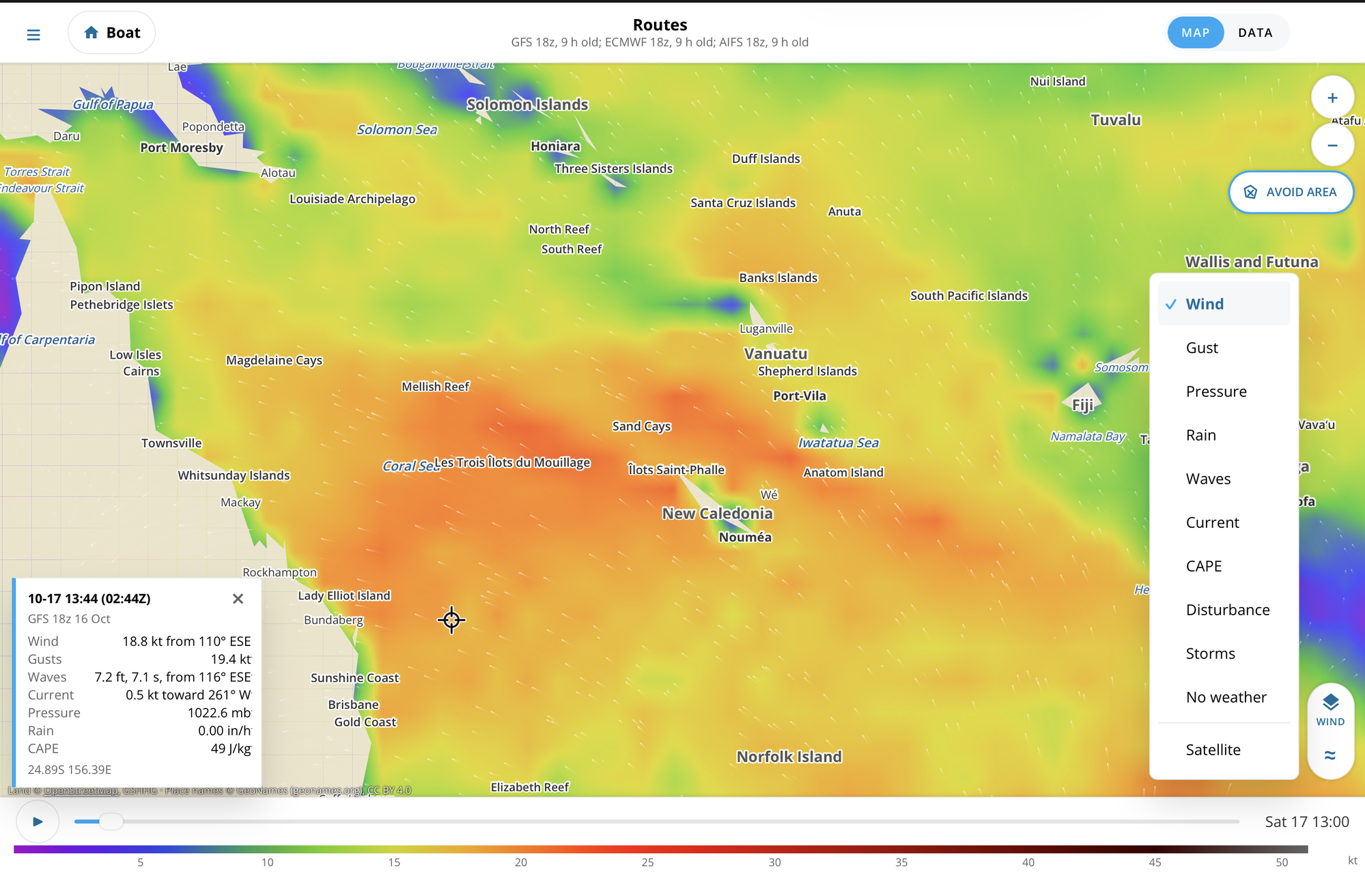
| Weather map | Wind and gusts as moving streaks, pressure with isobars in millibars, rain, waves (streaks follow the wave direction), CAPE, and ocean current. Scroll through the forecast with the time slider. |
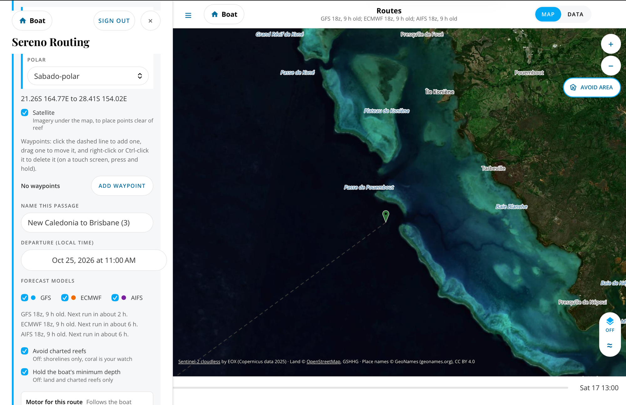
| Satellite and place names | Satellite imagery under the weather, place names from GeoNames, and the coast and reefs drawn over the top. |
| Weather Display | Tap anywhere for that spot's forecast: wind, gusts, pressure, waves, rain and CAPE through the run. |
| Upper air disturbance | The spin at 850 hPa, about 1,500 m up, outlined where it's strong. A route or plan gets a note only when a closed low, low shear, a warm core, moisture and CAPE all line up. |
| Official storm warnings | Active tropical cyclones from NHC, JMA, JTWC and Fiji, shown on the map and noted on routes they touch. |
| Light and dark | A night look for the cockpit, or automatic with the phone. |
Weather Routing
| Feature | What it does |
|---|---|
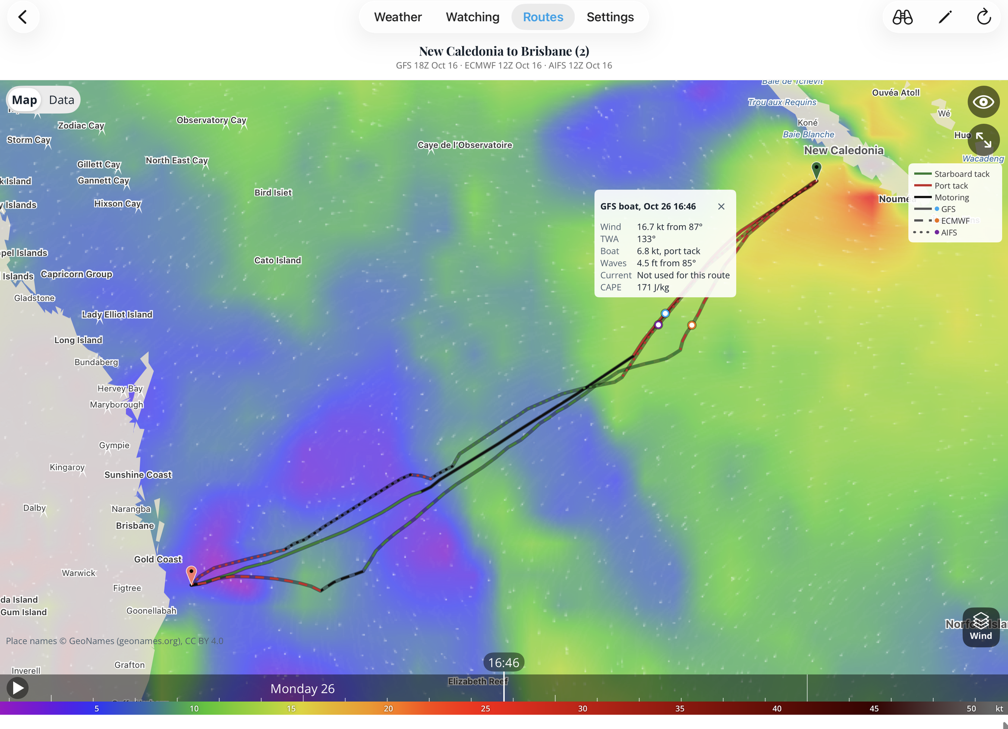
| Routes on all three models at once | One request routes on GFS, ECMWF and AIFS side by side, so you can see where the models agree and where they don't. |
| Your boat's polar | Choose from a library of about 180 polars, upload your own .pol file, or edit an existing one. Set separate day and night percentages to match how you sail. |
| Sailing angles | Your closest angle to the wind and deepest downwind angle, true or apparent, so the route tacks and gybes where your boat does. This is to fine tune your polar |
| Motor polar | Your boat's speed under engine by wind speed and angle so you have accurate motoring results. |
| Prefer sailing | The engine runs only where it's at least 30% faster than sailing. Turn it off to take whichever is faster. Sail only is a choice on any route. |
| Land, reefs and shallows | Routes go around coastlines, charted reefs (the UNEP-WCMC world reef map) and water shallower than your minimum depth (GEBCO depth). |
| Areas to avoid | Draw your own no-go areas on the web map; every route keeps out of them. |
| Wind and wave limits | Set the most wind and sea your boat will take. Routes stay inside them, and a route that can't says where and when it would meet them. |
| Ocean current | Surface current (NOAA RTOFS) is part of every route, and the table shows its set and drift along the way. |
| Waypoints | Add waypoints to route through a pass or round a cape in the order you choose. |
| Long passages | Passages up to about 3,000 nm. Past the end of the forecast the route carries on as an estimate on climatology, drawn dashed and labeled as such. |
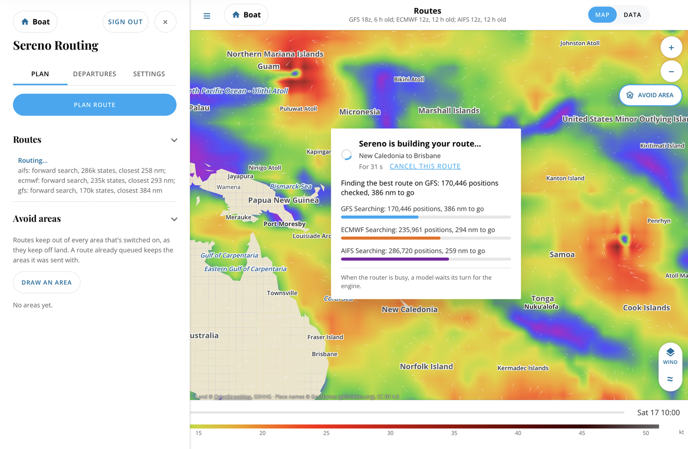
| Fast, with a clock | Most routes finish in a minute or two; every route ends within 3.5 minutes (8 over 2,000 nm). Watch its progress, see your place in line, or cancel it. |
| Honest failures | When a route can't be made (reef, land, limits), it says why, where, and what to try: a waypoint, another departure, a finish outside the pass. |
Route Results
| Feature | What it does |
|---|---|
| Route on the map | Each model's track, colored by tack, with the boat's position moving as you slide through the passage. |
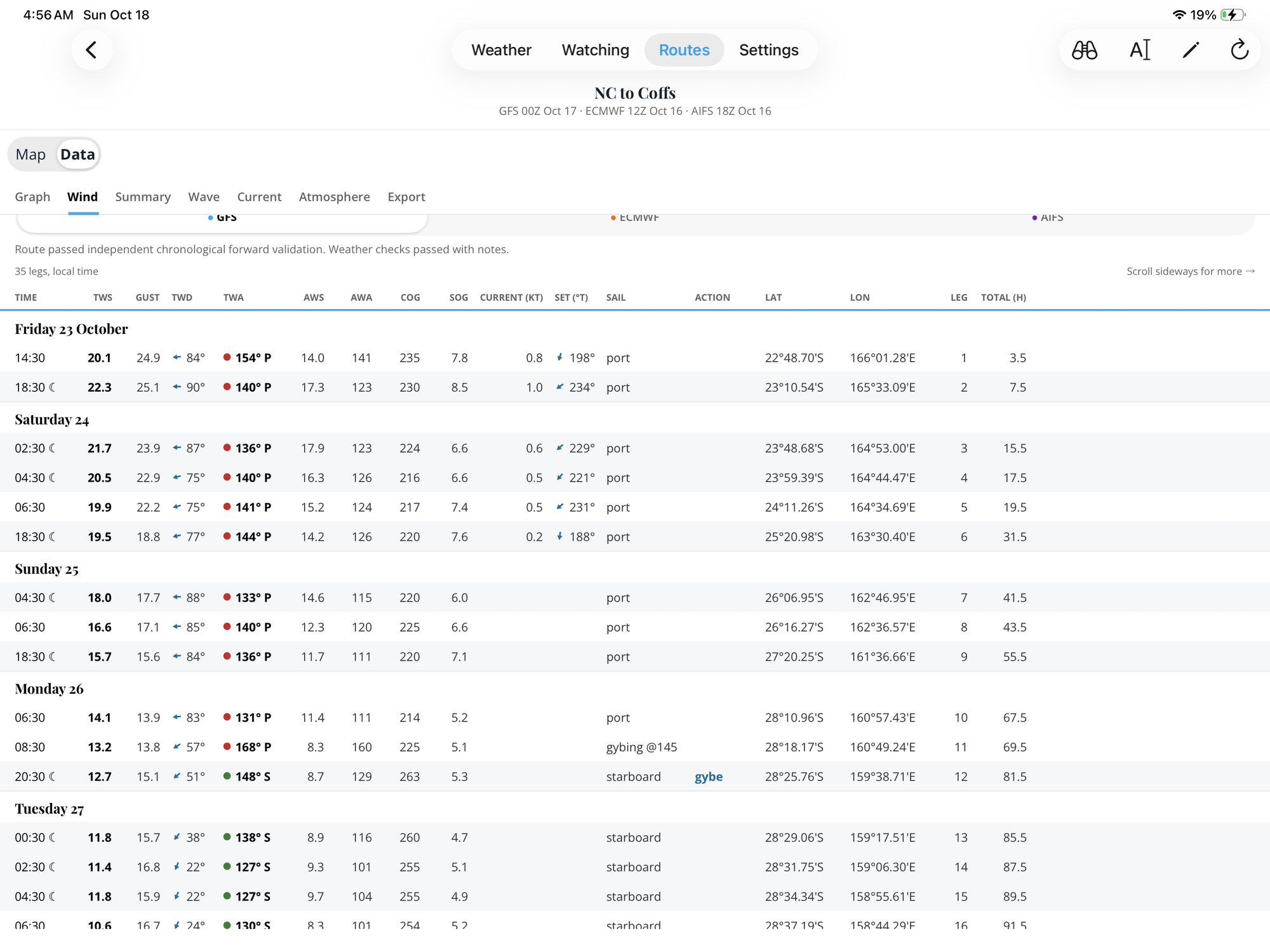
| Route table | Every leg: time, position, course and speed, true and apparent wind, gusts, sail plan or motor, tacks and gybes, waves, current, rain and comfort. |
| Comfort | Each leg rated Champagne, Easy, Coffee, Rough or Sick for your hull type and length, from the motion the sea makes, with the reason given. |
| Sea state | Wind sea and swell apart (from GFS-Wave on every model), the period to height ratio against the 2:1 line in feet, steepness, and a band showing where the seas meet the boat: bow, forward quarter, aft quarter or astern. |
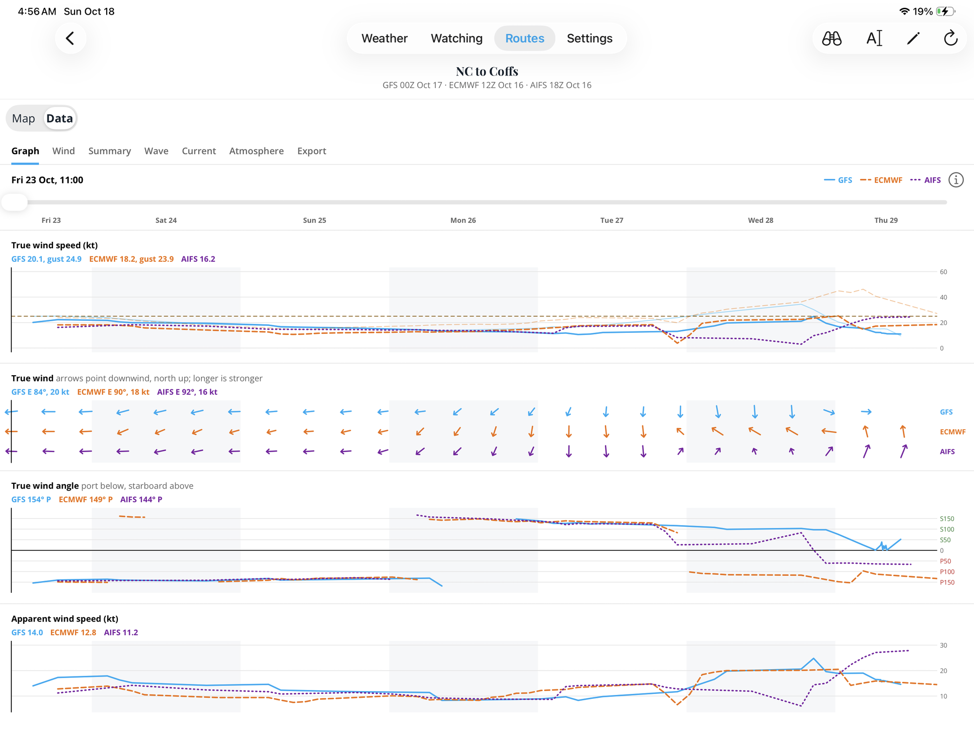
| Graphs | Wind, gusts, waves, period, period to height, pressure, rain and more along the passage, each model on one chart. |
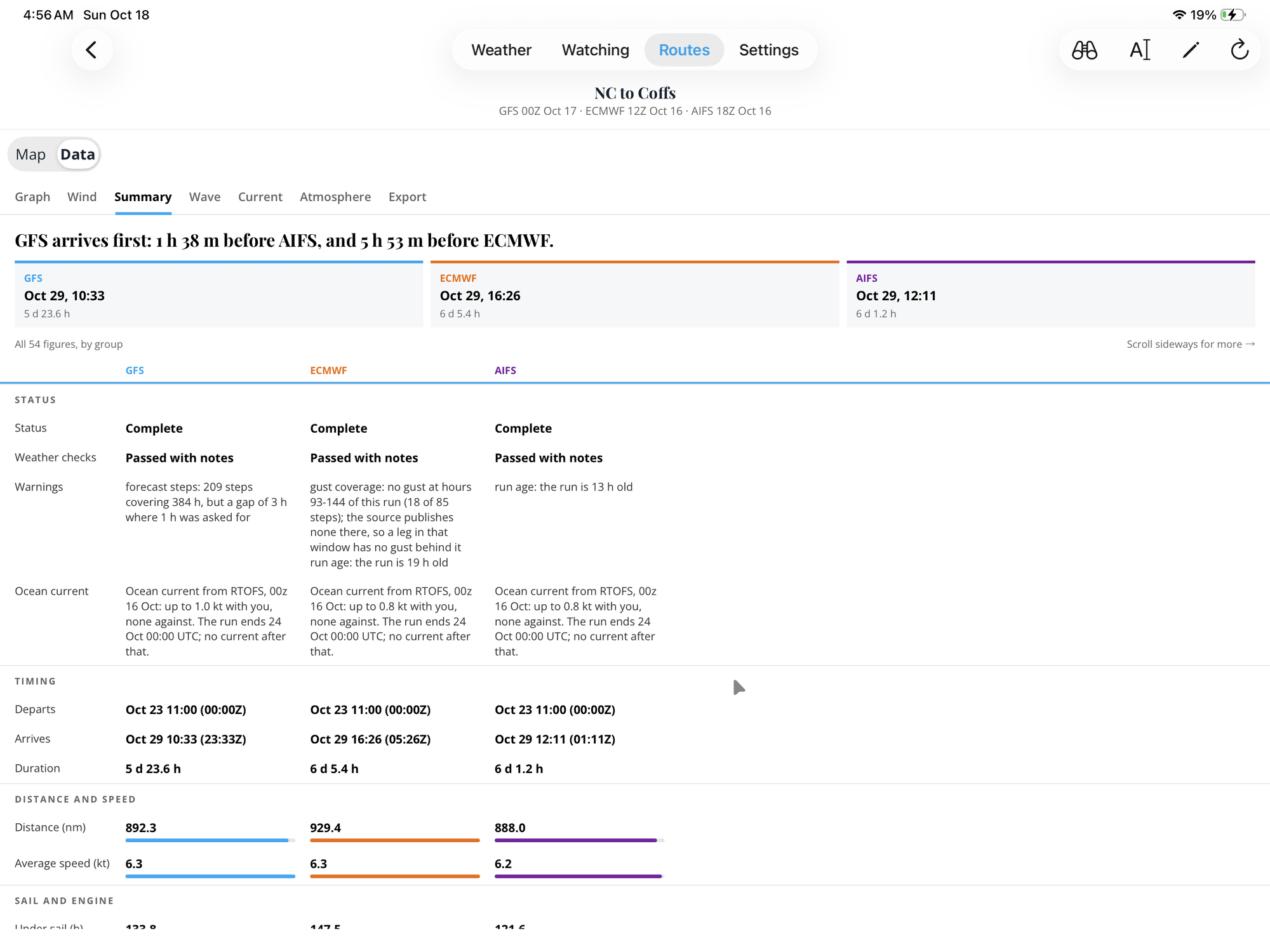
| Summary | Arrival, distance, time under sail and motor, tacks and gybes, worst comfort, strongest wind and highest sea, per model. |
| Fuel | Set your engine's fuel use and every report shows the fuel the route burns. |
| Route PDF | A report to print or share: the route, the day by day conditions, along-track charts, the sea, the ensemble spread and how it was made. |
| Exports | Any model's route as GPX for your chartplotter, its table as CSV, or the PDF. |
| Flags on rough patches | A route that would make slow progress, circle or zigzag is flagged with where and when, so you know before you trust it. |
Departure planning and Watching
| Feature | What it does |
|---|---|
| Departures | Screen up to 10 departure days at once. Each day is sailed by every member of the ECMWF and GFS ensembles (about 80 passages a day) on your boat's polar and motor. |
| A verdict for each day | Go, Warning or No, from your wind and wave limits and the comfort aboard, with the reason in plain words and where the ensembles disagree. |
| What each day holds | Passage time with its spread, comfort, hours motored, how much of it is upwind, on the beam or running, and where the waves meet the boat. |
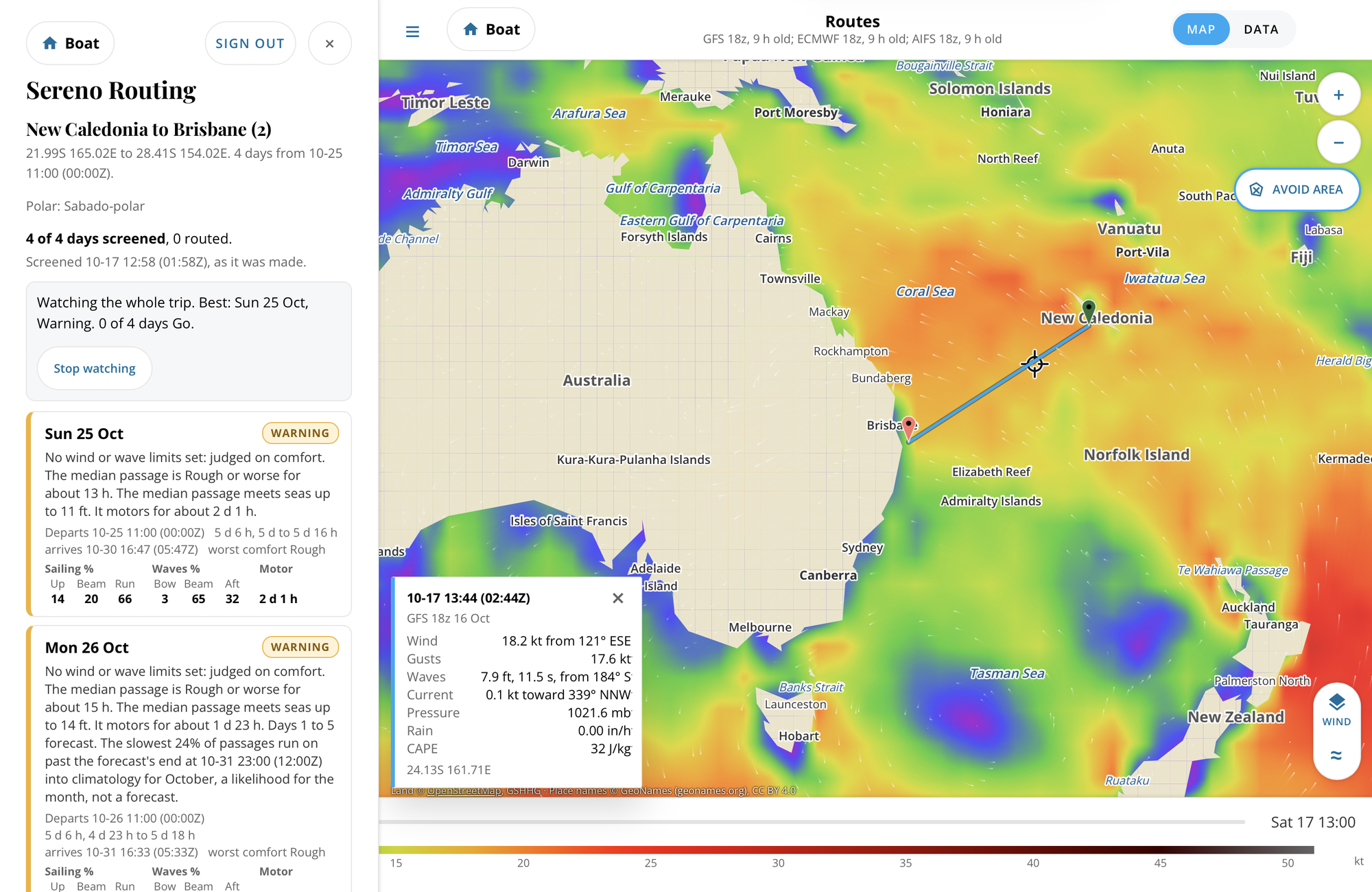
| Watching | Watch a whole trip or one departure day. It's screened again as each new ensemble run lands, with a log of what changed. |
| Alerts on your phone | The Android and iPhone apps tell you when a watched day's verdict changes. |
| Plan and watch from the phone | Make a trip, watch it, stop watching or delete it, on the web or either phone. |
| Passage brief | The weather story for the passage day by day, the official forecast, the sea, and the ensemble spread along your track. |
| Beyond the forecast | Long passages run past the forecast on climatology for the month, clearly identified. |
Apps and access
| Feature | What it does |
|---|---|
| Web edition | The full router in any browser at sereno.svsabado.com, laid out for a laptop, an iPad or a phone, and installable on an iPhone's home screen. |
| Android app | A native app with the map, routes, data tables, Watching and alerts, and an update check built in. |
| iPhone and iPad app | A native app with the same map, routes, Watching and alerts. |
| One account everywhere | Sign in with your svsabado.com membership. Your boat, routes and trips follow you between the web and both phones. |
| The Boat page | Your boat at a glance: what's planned, what's watched, and its live status from Saillogger. |
| Small downloads | The router does the heavy work and sends back only what the route needs, which matters on a satellite or mobile link offshore. |
| Your data is yours | Each person's routes and settings are kept apart, there's no advertising or tracking, and deleting your membership deletes your data. |
How it's made
| Feature | What it does |
|---|---|
| Built aboard | Designed and tested by Holly and Ray aboard Sabado. |
| Reports by rule | Every sentence in a report comes from fixed rules on computed numbers, never an AI writer, so the same weather gives the same words. Each report says how it was made. |
| Named sources | Weather from NOAA (GFS, GEFS, GFS-Wave, RTOFS) and ECMWF (IFS, AIFS, ENS); depth from GEBCO; reefs from UNEP-WCMC; coastlines from GSHHG; place names from GeoNames; satellite from EOX. Each is credited where it's used. |
| Planning, not navigation | Routes are for deciding when and which way to go. Navigate by your charts and what you see. |